STORM Caroline is due to hit Greater Manchester in the next twenty-four hours, with a yellow weather warning for snow being issued by the Met Office.

The storm has spent much of today battering Northern Ireland and parts of Scotland, and is set to hit Manchester at around midnight tonight.
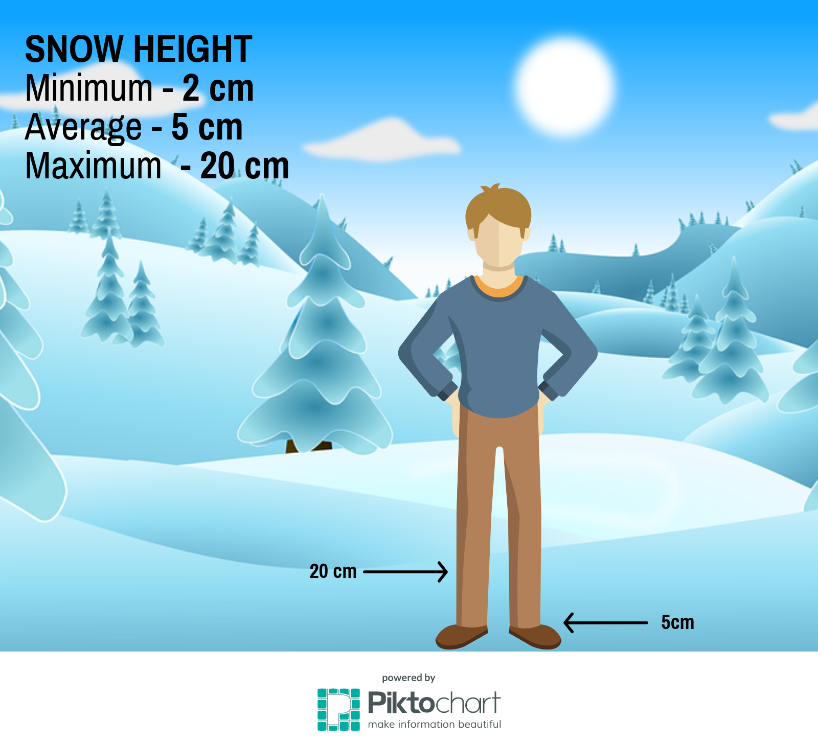
Meteorologists have estimated that the storm will leave between 2-5cm of snow, but with a chance of some places getting up to 20cm of snow.
Experts also predict that many surfaces could become very icy and hazardous, especially overnight, so make sure to take care when walking or driving about.
Grahame Madge, spokesperson from the Met Office, said:
“Storm Caroline will be worst in Scotland, but as the storm continues on its path east, it will be followed by much, much colder air than we have had so far.
“This cold air brings the risk of snow showers and cold weather.”
Weather map courtesy of Windy.com.
Weather reports indicate that temperatures could drop to zero degrees Celsius, but due to the storm’s high winds, it will feel more like minus two degrees Celsius.
A yellow weather warning indicates that the storm has the potential to change and become more powerful over the coming hours, so it is advised that people keep an eye on the weather on the Met Office website.
Yellow weather warnings also mean that the weather is extreme enough to affect travel, so expect delays on roads and public transport.
Please be aware that the Met Office has issued a yellow weather alert warning of possible snow and ice in Greater Manchester: https://t.co/2JVFXXSx1D #GMWinter pic.twitter.com/VLp7uDF7HV
— TfGM (@OfficialTfGM) December 7, 2017
Transport for Greater Manchester’s Twitter provides regular updates to any delays that might happen throughout Manchester, and you can check up on it here.
Storm Caroline is expected to abate over the weekend, and by Saturday evening it is predicted to only affect northeast Scotland.
#uksnow is on the way. Check out where will see some snow tomorrow #weatheraware pic.twitter.com/9PAfOe7ioU
— Met Office (@metoffice) December 7, 2017
Keep checking here on Quays News for the latest updates on Storm Caroline. More to come throughout the day.


Recent Comments